Empowering Climate Smart Agriculture with Copernicus and IoT Innovations
for Smallholder Farmers in Africa
"Driving Climate-Smart Agriculture in African Lake Victoria Basin"
KijaniSpace (GreenSpace in Swahili) is an ambitious initiative to advance smallholder farming in Africa by leveraging Copernicus Earth Observation data and IoT technologies. By integrating satellite data with local IoT infrastructures, the project ensures practical and impactful solutions tailored to the needs of African farmers.
At its core is the SpaceIoTBox, a “Solution Box” that simplifies access to Copernicus services and transforms data into actionable insights for farmers, particularly in the Lake Victoria Basin. Supporting both crop and fish farming, KijaniSpace also fosters learning and innovation, enabling climate-smart agricultural practices across the region.
Harnessing advanced Copernicus Earth Observation data to provide actionable insights for climate-smart agriculture.
IoT Kit
The SpaceIoTBox, an integrated Earth Observation and IoT toolkit, simplifies access to space data and local IoT resources for innovative solutions.
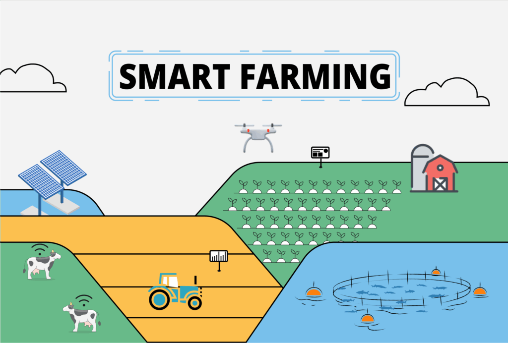
Smart Agriculture
Empowering smallholder farmers with technology to enhance productivity, sustainability, and climate resilience.
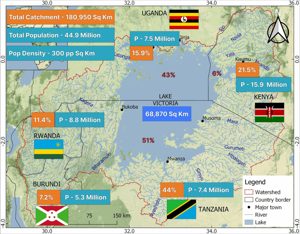
Lake Victoria Basin - Potentials, Challenges & Previous Interventions
Lake Victoria is a vital international waterway supporting transport, trade, and tourism while serving as a key resource for water, agriculture, and energy. Its rich biodiversity, thriving fisheries, and fertile agricultural lands sustain millions of livelihoods. Despite its vast potential, the region’s Blue Economy remains largely untapped, presenting significant opportunities for growth and sustainability.